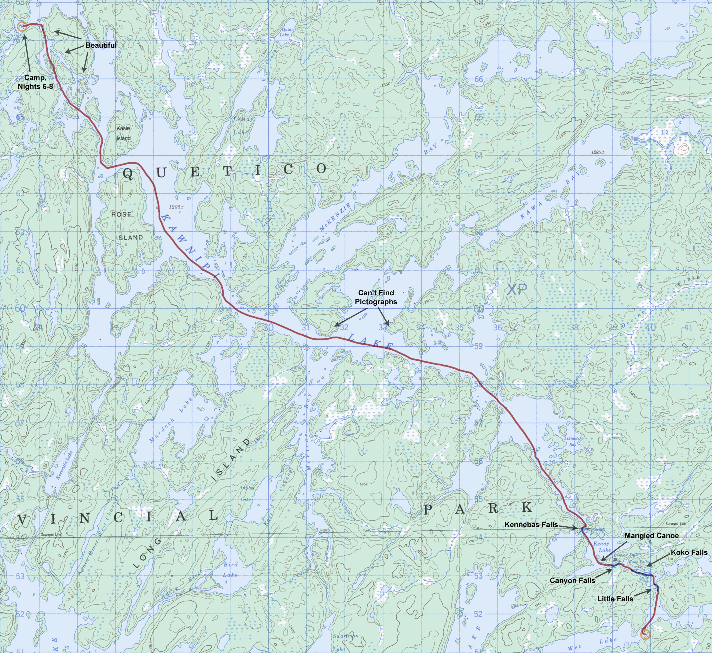
Day 7 - Wet Lake to Kawnipi Lake (Saturday, August 9)
17.3 miles, 4 portages
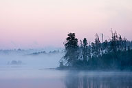
I crawled out of my tent well before sunrise to a beautifully serene morning.
A blanket of mist rested on the water, and the first light of morning was causing it to glow softly.
Above the mist the skies were mostly clear and calm.
|
Predawn calm on Wet Lake.
(click on any image for larger version)
|
|
|
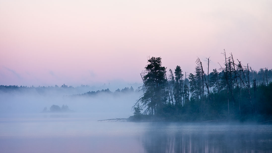
Sunrise colors. (Wet Lake)
|
|
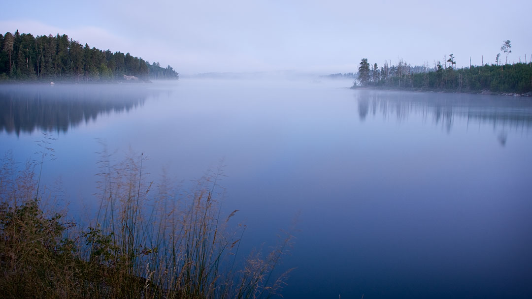
Rather than stay another day, I decided instead to bet on the weather and see how far I could get today across big Kawnipi Lake.
Still a relatively inexperienced solo canoeist, I felt it was wise for me to take advantage of these calm days when large bodies of water lay just ahead.
In addition, the increased numbers of people I was now seeing in this popular Falls Chain area was slowly beginning to erode my precious feeling of solitude.
As hoped, the paddling conditions were indeed ideal today.
The sky was sunny, the temperatures were cool, and the winds were generally calm.
I determined that if I could make it as far as Rose Island at the far northwest end of Kawnipi Lake, I would consider the day very productive.
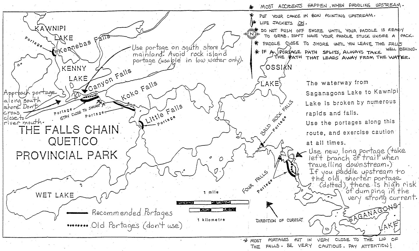
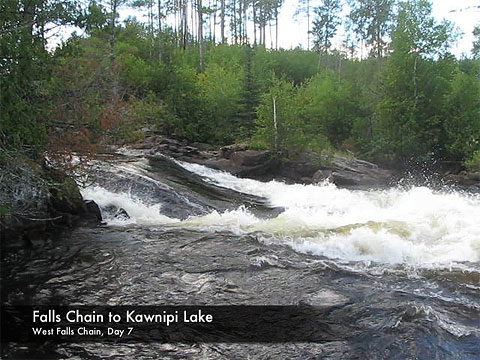
My first challenge, however, would be to get through the tough western half of the Falls Chain.
|
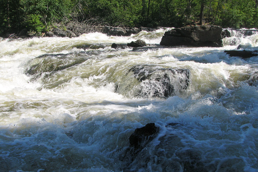
Little Falls. (Falls Chain)
|
|
Koko Falls. (Falls Chain)
|
|
Canyon Falls. (Falls Chain)
|
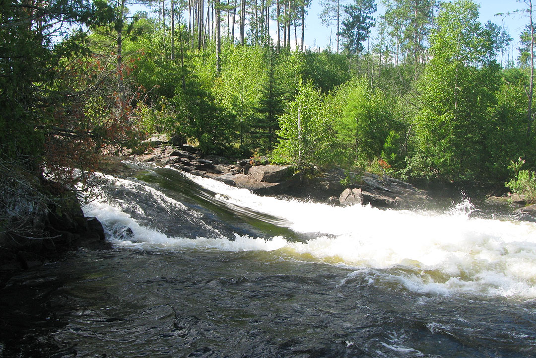
I said my goodbyes to Wet Lake and paddled the short distance to my first portage at Little Falls.
This would be my easiest falls to maneuver around today, and the approach to the portage landing was not difficult.
The portage trail itself was also not bad, and before long I was pushing away from the landing at the other side, being mindful to avoid the turbulent water at the base of the falls.
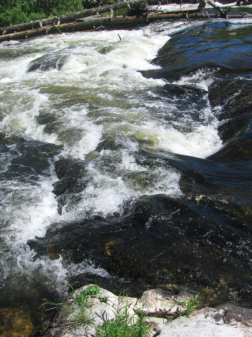
After another short paddle, I arrived at Koko Falls which is comprised of a series of drops along a narrow waterway.
The leading portage landing was a little trickier this time, but hugging the southern shoreline kept me safely away from any trouble.
The portage trail was longer and tougher than I had expected it to be, and at the far end I took a short break to take some pictures.
While I was photographing the falls a scout leader and his group caught up with me going in the same direction.
As I headed back to retrieve my second load of gear, I passed a couple of beleaguered looking scouts, one of whom wearily asked if the portage end was near.
I was happy to inform him that he was close, and after a quick tug at the huge pack on his back he slowly marched on.
The scout group was single portaging and moving fast, so after passing the last of the group I was pretty confident I wouldn't be seeing them again, and in fact I didn't.
Another short paddle further brought me to a rather nerve-racking portage landing at the top of Canyon Falls.
It is especially important to know in advance how to approach this particular portage.
If you don't hug the south shoreline on this one, you run a real risk of slipping over the lip of the falls.
There are two chutes at the top of Canyon Falls, but the main one draining out the north side is not easily seen until you're almost on top of it.
Paddlers approaching from along the opposite shoreline could easily find themselves caught in the strong current heading over the brink, and it is a long way down from there.
There are actually two portage trails around Canyon Falls, but the older trail that uses the long island separating the falls' two chutes is no longer recommended.
I took the mainland trail to the south, and it was plenty long and tough enough.
At one point I headed down a shorter secondary path which led me to a dangerous landing right next to the base of the falls.
Concerned about the rough water there, I went back looking for an alternate route and was relieved to find the main trail continuing on to a much safer landing further downstream.
On this extended portion of the trail I almost stepped in some extremely fresh wolf scat that definitely got my attention, but the beautiful views from the trail's higher elevations, overlooking Kenny Lake below, helped distract me from dwelling too much on whether I might encounter wolves on the path.
|
Overlooking Kenny Lake just past Canyon Falls. (Falls Chain)
|
|
The paddle away from Canyon Falls was no picnic either.
The currents there were deceptively strong, and again my pre-trip planning directed me along the south shoreline until I was safely out into Kenny Lake.
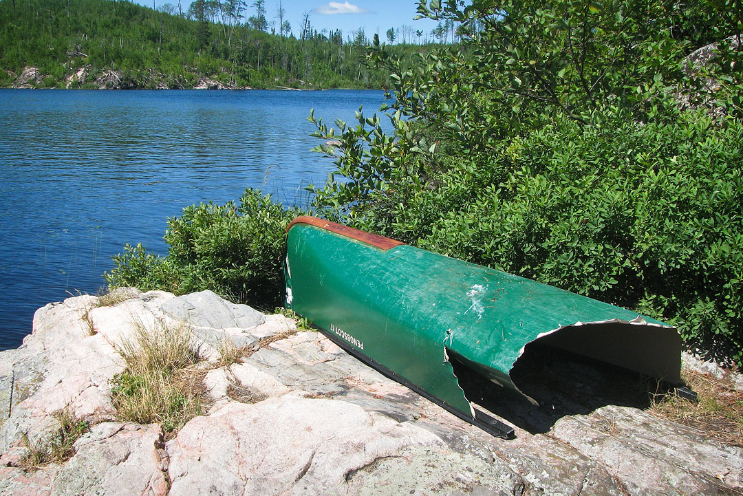
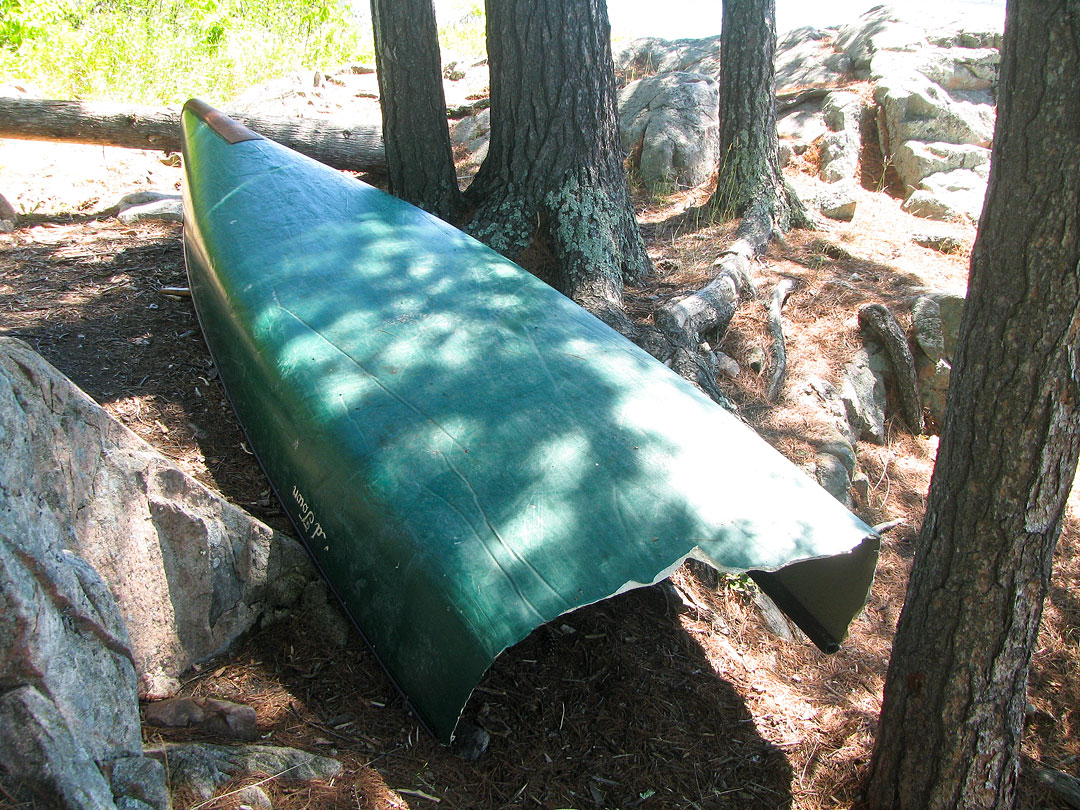
As I turned to head north, I noticed the distinct shape of a canoe off to the right and up on shore, but when I got closer it became clear that I was only staring at the front portion of a canoe that had been torn in half at the midsection.
After going ashore to investigate, I found the other half of the green royalex Old Town Penobscot 17 stashed in some bushes just a few yards further down shore.
On the stern read "V6 HoneyRock", words likely identifying the group that once owned the now mangled craft.
The wreckage was sobering evidence of what could happen to a canoe that takes that unfortunate plunge over Canyon Falls.
I just hoped that it had been unoccupied when it made that journey.
|
Mangled canoe near Canyon Falls. (Falls Chain)
|
|
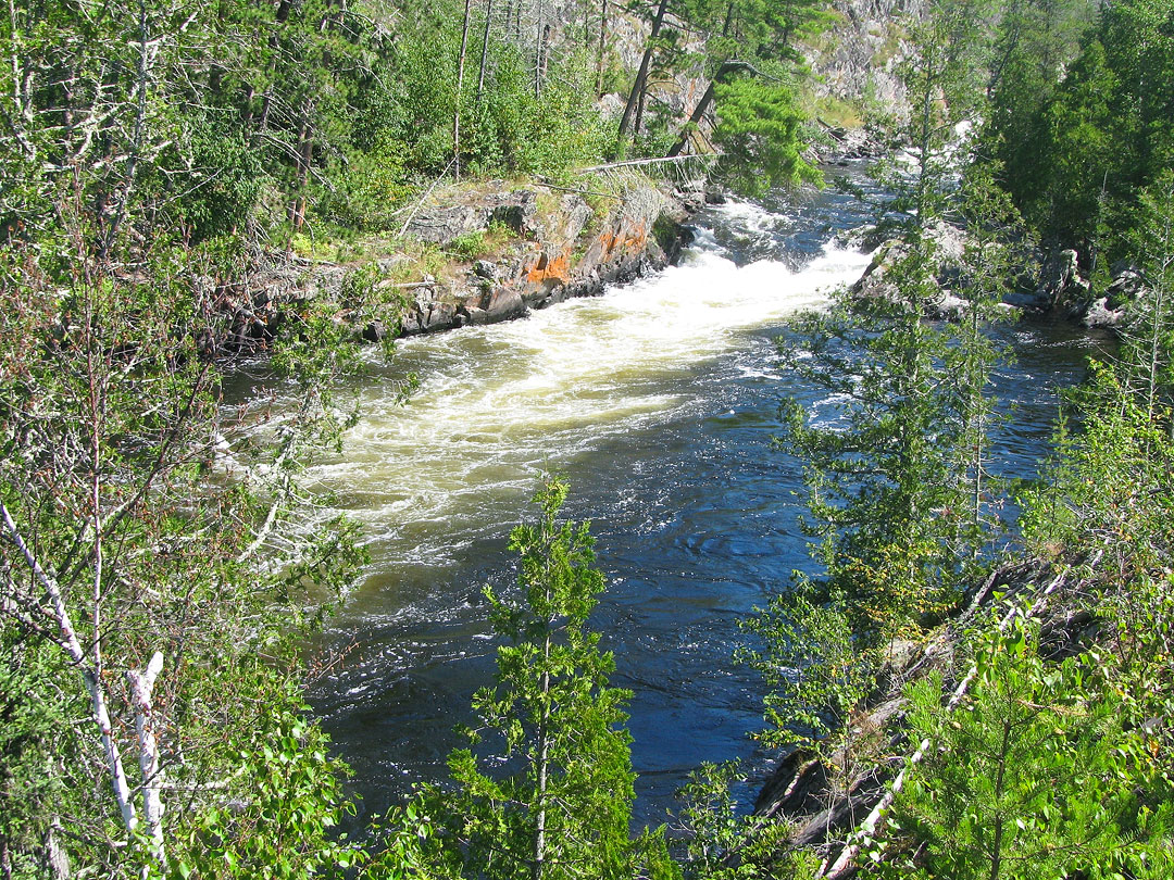
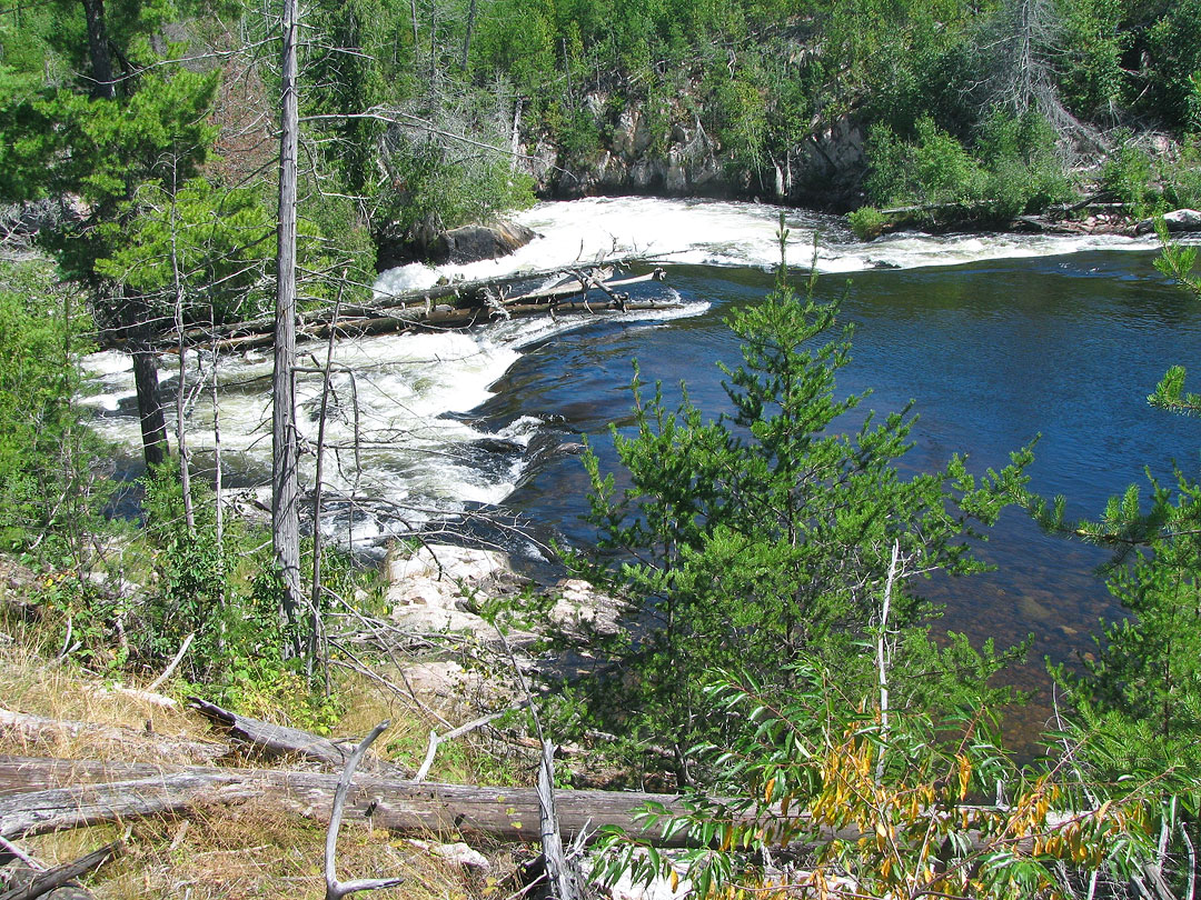
The final falls and last portage of the day were on the other end of pretty Kenny Lake at Kennebas Falls.
I curiously had trouble finding the proper landing for this portage, and after making a few trips along the shoreline I eventually ended up too far upstream at what otherwise looked like a reasonable enough spot to go ashore.
After struggling partway through some makeshift path, I finally discovered the real portage landing sitting right next to the lip of the falls.
It hadn't occurred to me to look so close to the falls, but after getting a good look at them now it was clear that they were the least treacherous of the chain and a closer approach seemed perfectly reasonable.
|
Kennebas Falls. (Falls Chain)
|
|
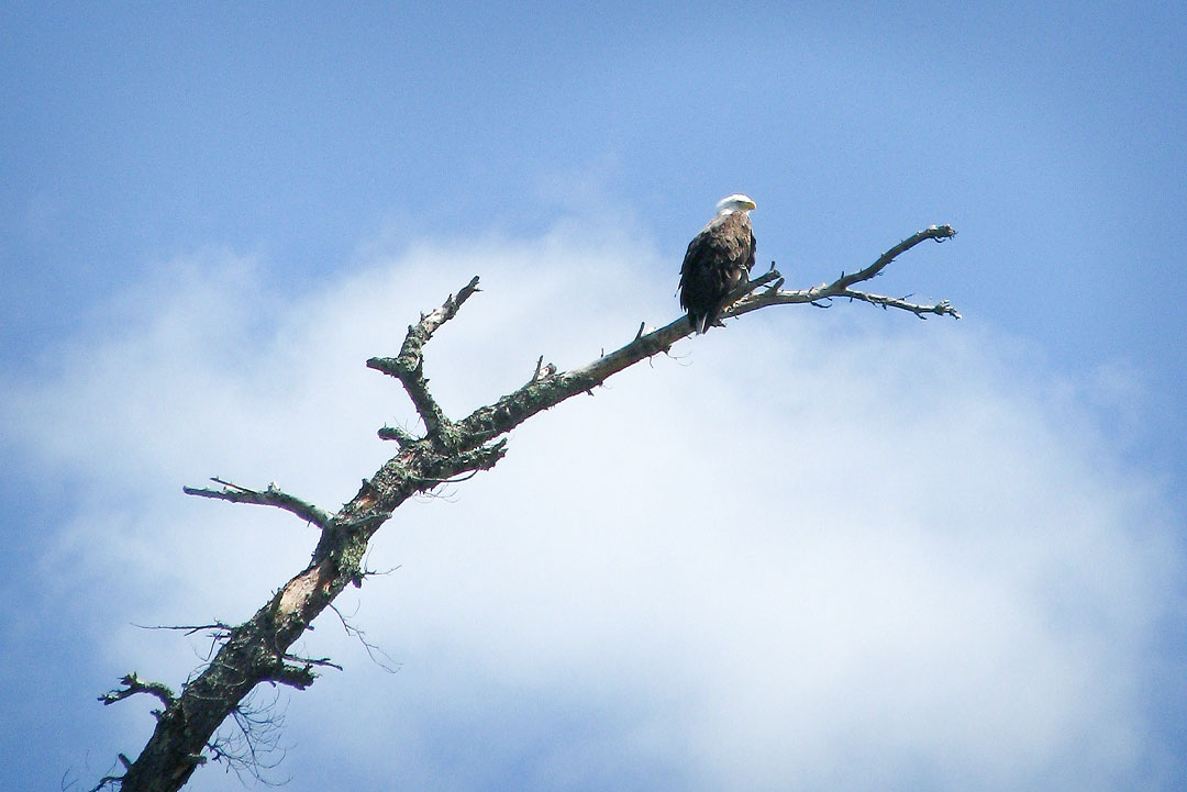
On the other side of Kennebas Falls an eagle, perched in a nearby burned tree, watched as I loaded the canoe and started out onto Kawnipi Lake.
Throughout the entire Falls Chain I had seen the many scars of past wildfires, but on this eastern side of Kawnipi Lake the effects were particularly striking.
The entire landscape for miles in every direction was wiped bare of taller trees, and what covered it now was just a low, even carpet of new growth.
|
Eagle watches from portage at Kennebas Falls. (Falls Chain)
|
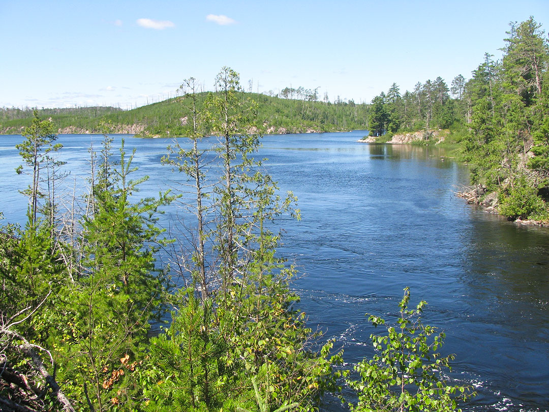
Throughout the afternoon I continued paddling hard and steady across the great expanse that is Kawnipi Lake, eventually returning to a landscape lined with mature pine and spruce forest.
I tried to find the pictographs located on the cliffs at both sides of the entrance to Kawa Bay but was unsuccessful.
As the afternoon grew late the wind picked up just enough to add some extra work for my already aching paddling muscles.
I was relieved to finally clear the bend northward past McKenzie Bay and to see Rose Island come into view.
For the first time on big Kawnipi Lake I saw people, two fishing from a canoe near Rose Island followed by a group camped a little further up along the eastern shoreline.
I still had energy and was making good time, so I decided to push on past Rose Island and try to reach the smaller, more intimate waterways near the start of Kahshahpiwi Creek.
Just past Rose Island I turned west, paddled between both Rose and Kasie Islands, and then resumed traveling northwest through a series of beautiful side channels until I reached the bend swinging southward toward Kahshahpiwi Creek.
These quiet side channels with their scenic high cliffs and small bays were a welcome change from the big open waters of the main Kawnipi basins.
I was now in paddling heaven.
I quickly began looking for a campsite and found the perfect spot just around the bend on a small island.
The island had very nice views, a large fire ring, great tent pad and even its own private bay directly behind it.
After many days of arduous travel, I had finally reached the most remote spot along my route, and I was now ready to settle in to an ideal campsite and enjoy some hard earned rest and relaxation.
|
Route Map, Day 7 (click to enlarge)
|
|
|
Falls Chain Map (click to enlarge)
|
|
Video (click image to play)