|
|
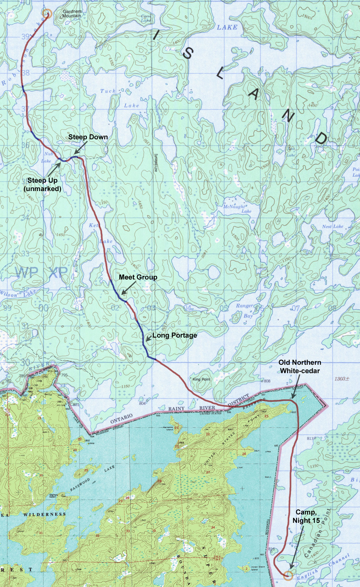
Day 16 - Robinson Lake to Basswood Lake (Monday, August 18)
13.4 miles, 6 portages
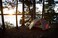
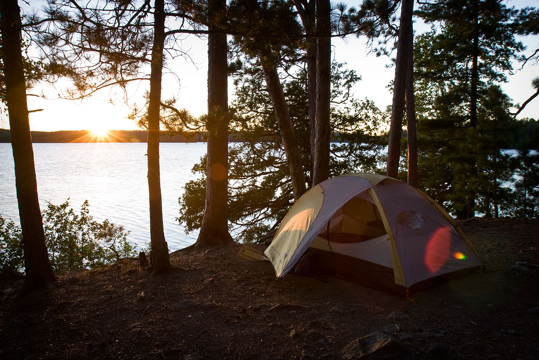
A new morning dawns on Robinson Lake. (click on any image for larger version) |
I was up early to get a jump on the day. Perhaps sensing my busyness, Junior and the squirrels seemed a little more active than usual this morning. I had grown quite attached to this campsite and its residents, and it was sad to leave. It was also hard to go because it meant I would now be making the last major turn in my route, in effect closing the final loop.
My original plan had been to head back out of Robinson Lake the same way I had come in, through Tuck and Sarah. However, over the past few days I had gradually changed my mind, and now I was settled on a route that exited south to Basswood Lake through Nub and Kett. From there I would follow Basswood east along the United States and Canadian border all the way back to Prairie Portage. The advantages to this route were seeing new places and getting most of my remaining portaging out of the way today. The disadvantage was having to paddle huge Basswood Lake where conditions can get difficult.
My paddle down Robinson Lake was swift, helped by wind at my back. The first portage into an unnamed lake was short and fairly easy, and after a brief paddle I came to the next portage into Nub Lake which was slightly longer and tougher. Neither portage appeared heavily used, by people anyway, and in fact the moose prints along the muddy paths seemed to outnumber the human ones. The combination of dense underbrush and poor trail visibility once again raised concern about whether I might bump into a moose somewhere along the path. These smaller lakes seemed like prime moose habitat, and it was still early morning.
I saw no moose but did encounter a couple of otters swimming along the shore on Nub Lake. At the other side of Nub I came to a portage that was not indicated on the map. Even so, I was not particularly surprised to find it, considering the high ridge that rose before me, and the portage trail itself lived up to expectations by climbing steeply. Luckily for me, my food pack had become lighter by this stage of the trip, and the climb was not as bad as it could have been.
The small unnamed lake at the top of the climb was pretty and felt very remote and intimate. There was a minimal campsite on the far shore, at the start of the next portage, and I made a mental note to myself that this could be an interesting place to spend more time on some future trip. The portage on the other side of the lake was almost as steep going down as the previous one had been going up, but all in all it wasn't too bad.
Once onto Kett Lake it was nice to finally paddle for a while. At the far end of Kett was a long, but not difficult portage leading to another unnamed lake. At the end of the portage I came across a group of four guys heading in the opposite direction. I stopped to talk briefly with them, and they mentioned that they were headed to some lake just off of Sarah for a few days of fishing. I asked them about the long portage ahead into Basswood, and they warned me about a few tough spots, one in particular that ran through a tricky patch of mud. While talking with them it occurred to me that these were the first people I had seen in four days.
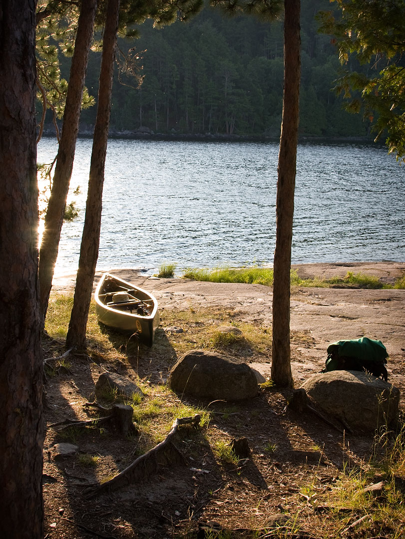
The long portage to Basswood Lake did indeed have its tough parts, but some sections were also very easy, sometimes running along stretches of flat granite that felt more like city sidewalks than the ankle-busting trails to which I had become accustomed. This time, due to its length, I decided to leap-frog my gear over the portage in stages rather than make two long trips. This allowed me to spread out the periods of rest, making the overall trip much more pleasant. Soon, my sixth and final portage of the day was done, and I was looking out over a choppy Basswood Lake.
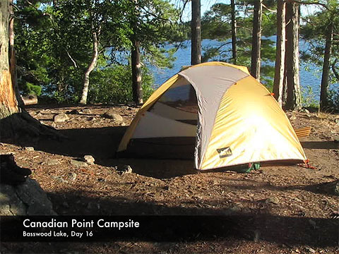
Basswood Lake was windy this afternoon, but I suspect that's the rule rather than the exception for this huge border lake. Initial headwinds turned more to my back as I closely rounded United States Point and headed south. On the very tip of United States Point, I could see one of the few ancient northern white-cedars that still exist on this lake leaning out from shore. Its gnarled branches seemed to point the way past like some archaic sentry, abandoned long ago by its unit. It felt a little strange to be just yards away from my home country but know I couldn't land there. My permits were for Quetico, not the BWCAW, so technically, I was restricted to Canada for the remainder of my trip. It only seemed fitting, then, that my next stop after United States Point should be Canadian Point where I finally decided to stop and make camp for the night.
I had noticed very few fellow canoeists out on Basswood Lake today, but from my campsite on the far tip of Canadian Point I did begin to hear the distant sound of the occasional motor boat. Motors of up to 25 hp are allowed on portions of Basswood Lake, including the U.S. side east of Canadian Point. I hadn't fully factored this in when earlier deciding to alter my exit route, and camp was now beginning to feel a bit less remote. Fortunately, an unusually large group of loons had gathered just off the point, and their loud yodeling cries helped drown out the far-off motors.
|
It was much cooler this evening, and the wind on the point made conditions quite chilly. For the first time on this trip I used my rain jacket as a wind breaker just to stay warm. Still, it was a beautiful evening and I enjoyed a nice sunset before hitting the sack.
|
Video (click image to play)
|
| << Prev | Next >> |
| A Quetico Solo | Copyright 2008 Tom Pinkerton |