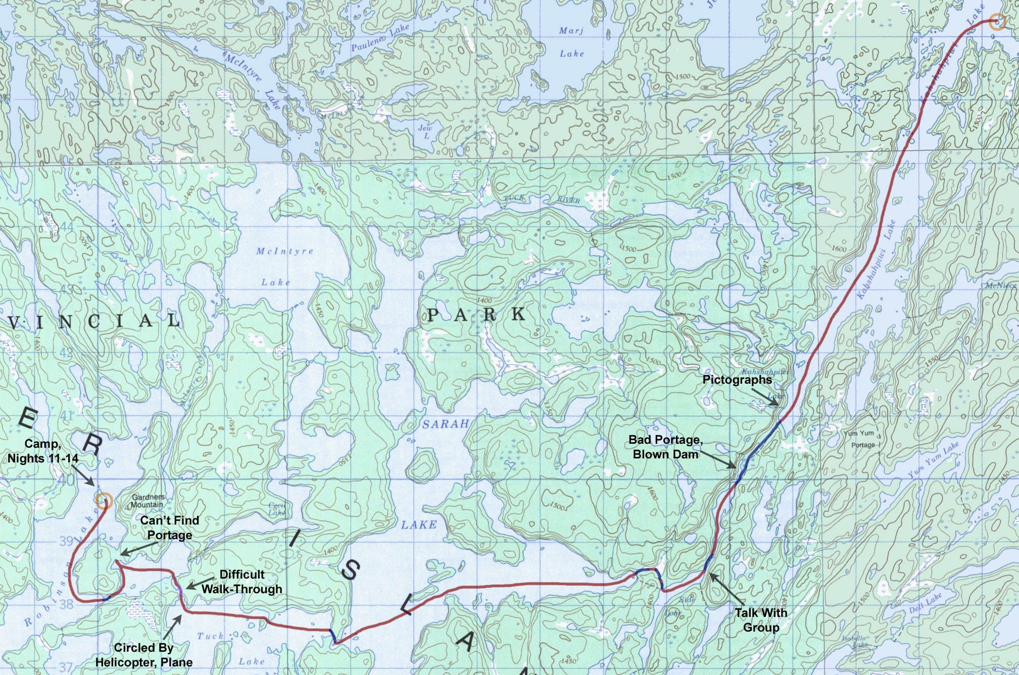
Day 12 - Kahshahpiwi Lake to Robinson Lake (Thursday, August 14)
15.5 miles, 8 portages
|
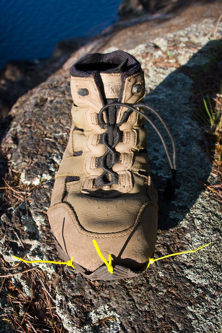
Boot repairs.
(click on any
image for larger version)
|
|
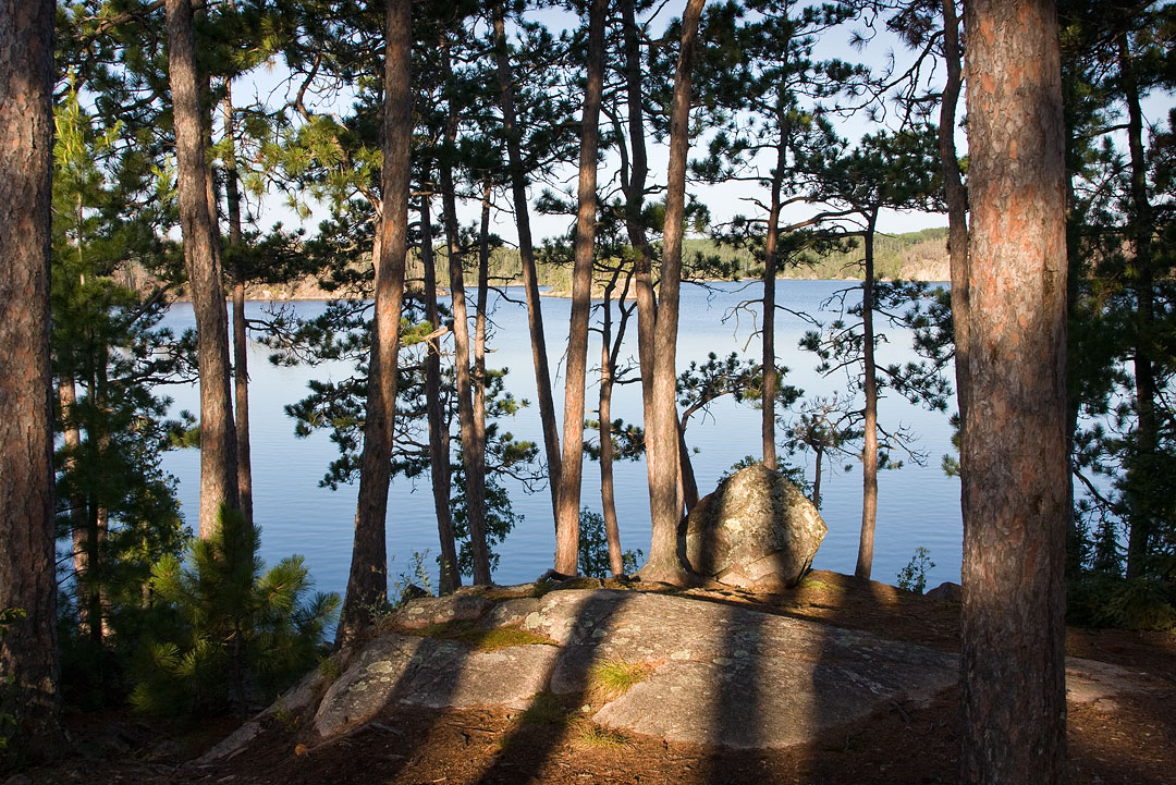
Morning view. (Kahshahpiwi Lake)
|
|
View atop campsite. (Kahshahpiwi Lake)
|
Another long day of travel was in store today, but my departure was delayed a bit by wet gear and boot repairs.
The sole separating from my right Chota Quetico Trekker was getting much worse and needed to be fixed.
Luckily, Heidi had suggested adding zip ties to my gear list just before the trip, and they functioned perfectly as sutures holding the boot together.
I guess one could say that Heidi saved my sole.
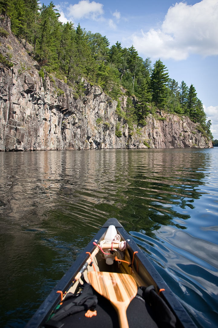
My plan today was to make it to Robinson Lake, which meant I first had to paddle the full length of Kahshahpiwi.
Popular Kahshahpiwi Lake is very long, and it took me well over an hour to complete the paddle from far north end to far south end.
Along the way I only saw two groups, one camped and another out in a canoe.
Further along I passed the location where a ranger cabin and fire lookout tower were supposed to be located, but I could not spot either one from the water.
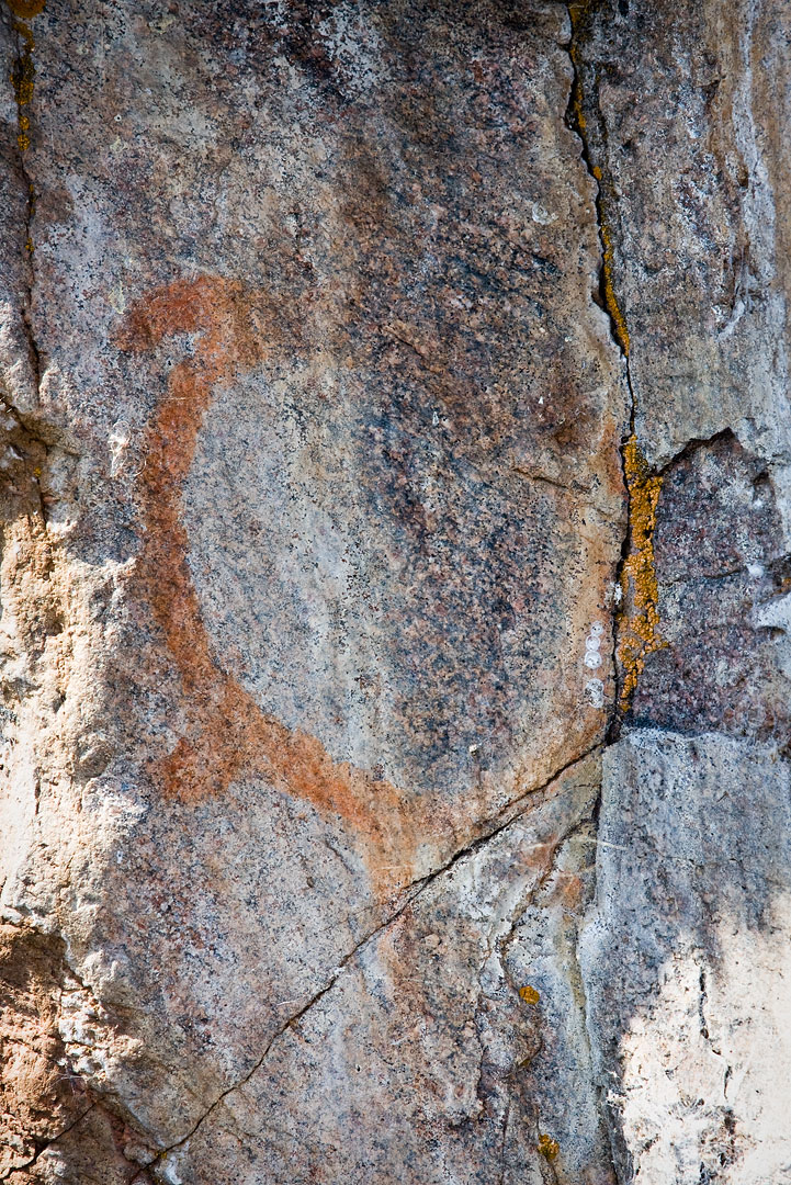
Finally, after reaching the south end of the lake I stopped to visit the pictographs located there.
These pictographs seemed more faded than the ones on Trant Lake, and it was less clear what they represented.
One looked like a salamander, another resembled a turtle, and still another looked like a canoe with seven or more occupants.
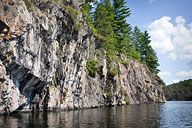
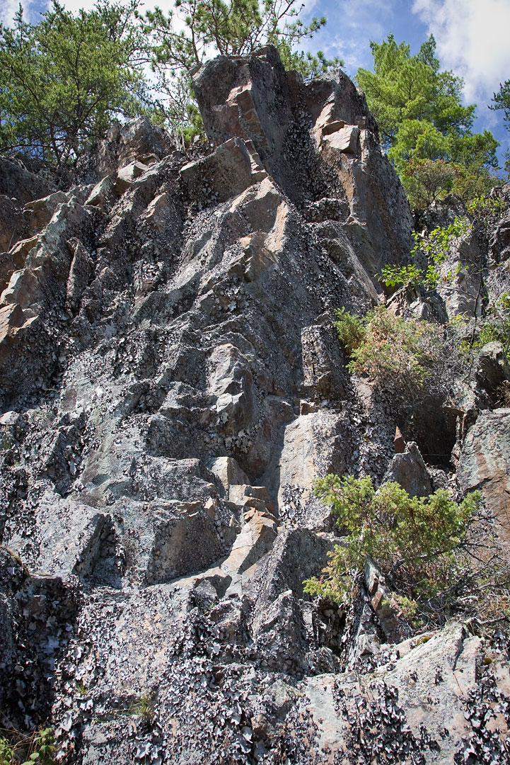
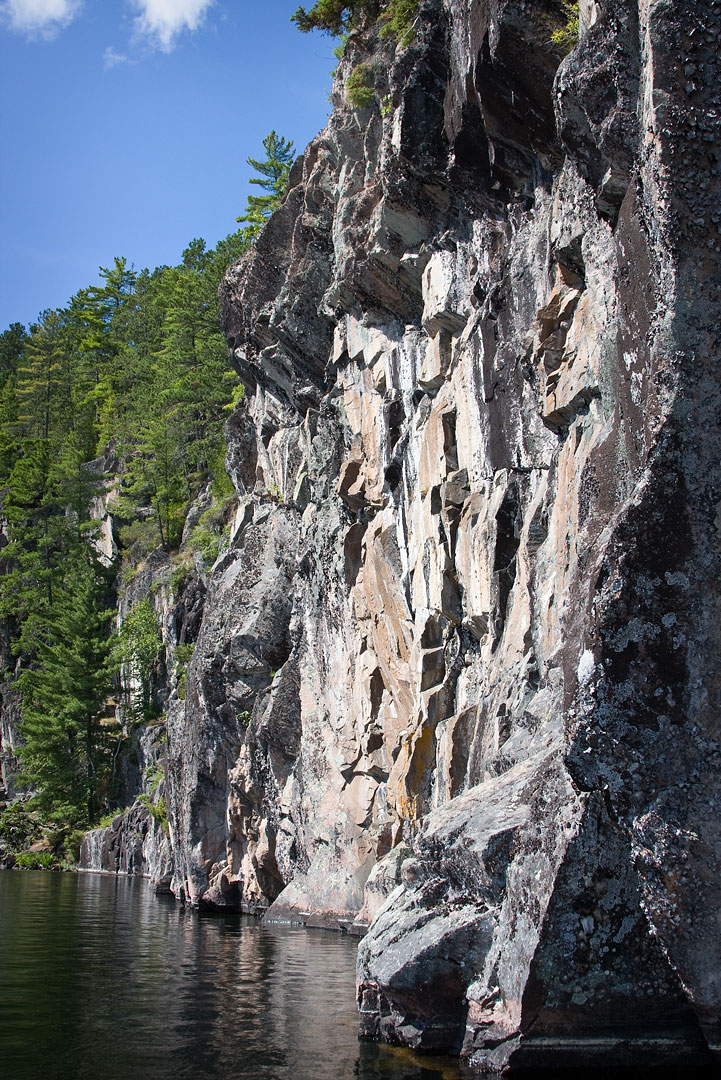
The pictographs were all located along a beautiful and very impressive line of cliffs that rose high above the water.
They were only a short distance from my first portage of the day, a portage that would soon win the title as the trip's most difficult.
|
Approaching Kahshahpiwi Lake pictograph cliffs.
|
|
|
Kahshahpiwi Lake pictographs.
|
|
|
Cliffs at south end of Kahshahpiwi Lake.
|
|
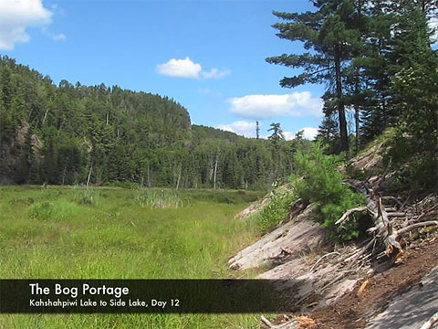
The long portage exiting the south end of Kahshahpiwi Lake began with a relatively easy trek along a mostly level path that cut through a lengthy stretch of forest.
At first I thought that I had lucked out on this one, but that feeling quickly eroded when the trail swung around into a clearing and began following the base of a ridge along the west side of a wide ravine.
A short way into this clearing, the trail turned to mud and eventually disappeared into a field of waist high muck skirted by huge boulders.
Unable to find a way through the muck or over the boulders, I finally had to drop the canoe I was carrying and start searching for an alternate path.
I didn't know it at the time, but the reason for the disappearing trail was a blown beaver dam that had drained the pond that was now just this field of muck with a little stream running through it.
After slogging back and forth across this pond I finally found a way over to the other side and discovered that I could more or less follow the base of the east ridge, through a gauntlet of bees, all the way to the portage landing.
I then retraced my steps back along the east ridge and cut straight back to the main trail where some birch logs had been laid across the path.
I had noticed these logs before but had obviously not understood the detour they were trying to signal.
Now equipped with this hard earned knowledge I returned to rescue my previously abandoned canoe over at the west ridge and eventually completed the portage.
After a brief paddle across an unnamed lake I reached the the next portage, a short but tough little trail into Side Lake.
At the other end I met a group of men and one young boy traveling in the opposite direction.
I explained the situation with the portage to Kahshahpiwi, and they filled me in about the portages to Sarah Lake.
I had the choice of either taking one long portage or three short portages over to Sarah.
The consensus of the group was that the three short portages were the lesser of the two evils, so that's what I chose.
The one long portage must have been a real doozy, however, because the three short ones, though quite pretty, were definitely no walk in the park.
Concerned with the lateness of the day, I worked extra hard to make good time across both Sarah and Tuck Lake.
The portage between Sarah and Tuck was short and easy, and the paddling across both was relatively uneventful until I neared the portage out of Tuck Lake.
There I spotted both a helicopter and float plane that passed overhead a few times and seemed to be circling.
After watching them for a while I finally concluded that they probably weren't interested in me, and I proceeded on to the portage.
In an effort to save time I walked the canoe along the stream at the next portage.
It was barely doable, and I had to hang on tight to both the canoe and anything else I could get my hands on to keep from being swept off my feet by the current.
In hindsight it was probably not the wisest choice, but I was really running late and needed to move quickly in order to make it to Robinson Lake before dark.
My target destination on Robinson Lake was the campsite on the island across from Gardners Mountain.
I tried to take the more direct route out the northwest corner of the next unnamed lake into Robinson, but instead of a portage trail all I could find was mud, deadfall and moose tracks.
My attempt to find the other portage further south was a success, however, and soon I was standing on a little sand beach over on the Robinson Lake side of the trail.
Racing the dropping sun, I hopped into the canoe and made a beeline for the island.
I made it there just before sunset and was relieved to find the campsite vacant.
In fact the whole lake had seemed vacant as I paddled through, and it felt like I had the whole place to myself.
The campsite was amazing and by far the best one of the trip.
I quickly set up camp and prepared to stay for a while.
I was very sore after today's hard paddling and many portages, and it felt great to finally relax.
|
Route Map, Day 12 (click to enlarge)
|
|
Video (click image to play)