|
|
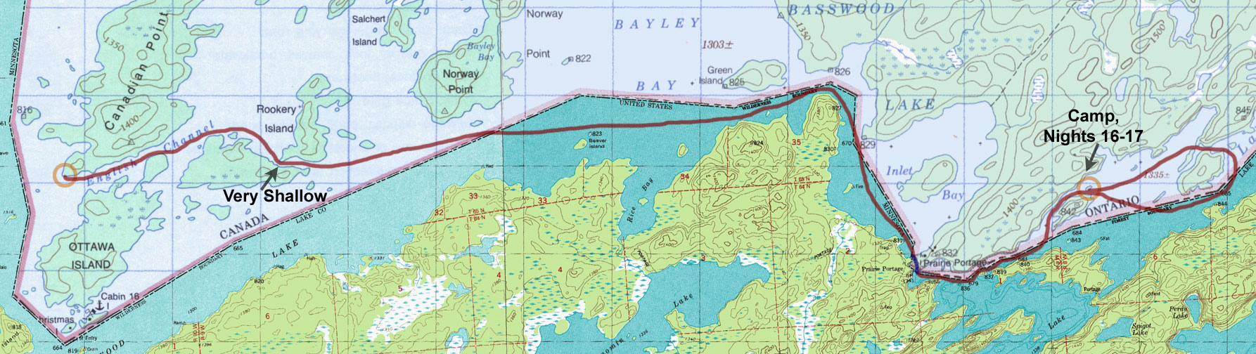
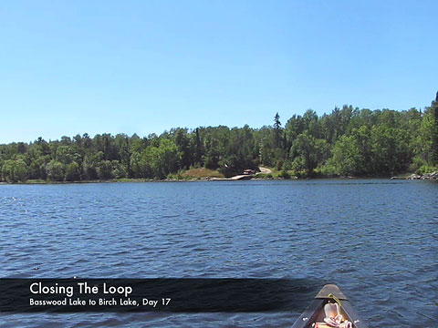
Day 17 - Basswood Lake to Birch Lake (Tuesday, August 19)
11.8 miles, 1 portage
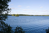
View of Basswood Lake from Canadian Point campsite.
(click on any image for larger version) |
It was a bright and sunny morning but the chill was still very much in the air. In the morning light I got a better look at the large trees around camp, many of which had been snapped off midway up or higher. Clearly, this exposed point had received more than its share of bad winds, and I would not want to be caught in a storm here. In fact, I would ordinarily try to avoid a campsite containing as many widow-makers as this, but the next site just down the shoreline had already been taken by the time I had arrived the day before.
During a leisurely breakfast the couple who had been camped at the other site passed by in their tandem canoe and waved. They were headed west back toward the wilderness, while I was headed east toward ranger stations and motor boats. Over on the far side of the lake the motor boat activity had gradually increased throughout the morning as fisherman raced to their favorite spots and tow boat drivers delivered their passengers. The tow boats would spawn groups of canoes that would then scatter out onto the lake and weave among the distant islands. At one point I saw what looked like an enormous canoe near the far shore, but eventually it split into three smaller ones like some replicating single-celled organism. It was clear that I would not be alone today.
The trip up Basswood Lake was long and tough. The day's journey began with a paddle along the English Channel between Canadian Point and Ottawa Island. Then after skirting Big Merriam Bay I passed through the narrows south of Rookery Island and turned the canoe east toward Norway Point. Past Norway Point the lake completely opened up to huge Bayley Bay where there was simply no hiding from the elements. The wind and waves tossed my little canoe around like a toy, and the motorized fishing boats that periodically passed by demonstrated why they were the better match for this big water. When the ranger station at Prairie Portage finally came into view I let out a big sigh of relief. That final paddle across Inlet Bay seemed to take forever, but soon I was pulling the canoe onto the sandy beach and preparing for my last portage of the trip.
After a quick stop at the Prairie Portage store for a T-shirt, I returned to the beach to begin my portage. I stopped briefly to speak with a man and his son who were just beginning their trip. They were headed for some lakes just north of Robinson, Tuck and Sarah where they hoped to see wildlife and do some fishing. Even after nearly three weeks of traveling I was still a touch envious that their adventure was just beginning while mine was almost over.
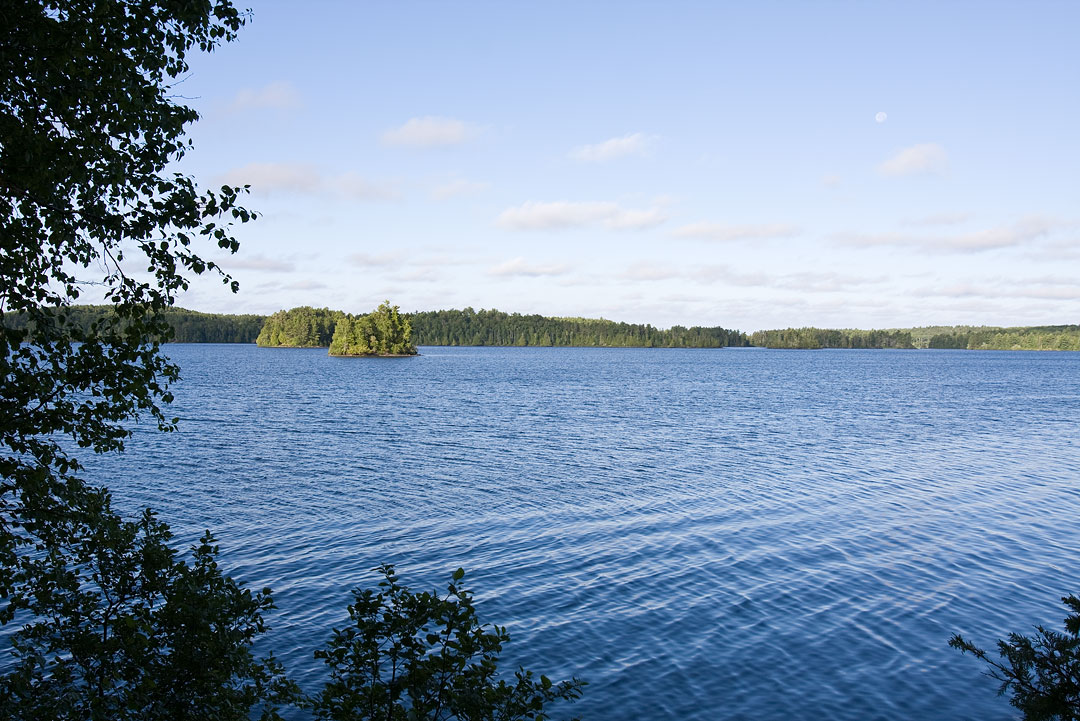
Past Prairie Portage I continued along the U.S. and Canadian border to Birch Lake where I planned to base camp for a few days before paddling out. I had hoped to get a nice campsite on the western side of Birch to minimize the amount of paddling I would need to do on my last day. But regardless, when I reached the first site shown on the map, it was occupied. As I continued across the lake, I gradually discovered that all the sites on the Canadian side were taken, except for one very undesirable one. As a last resort I spotted a small island back to the west that looked like an attractive place to maybe create a site of my own. Unlike in the BWCAW where you are restricted to camping at designated sites only, in Quetico you are allowed to camp just about anywhere you'd like.
Unmarked Birch Lake campsite.
|
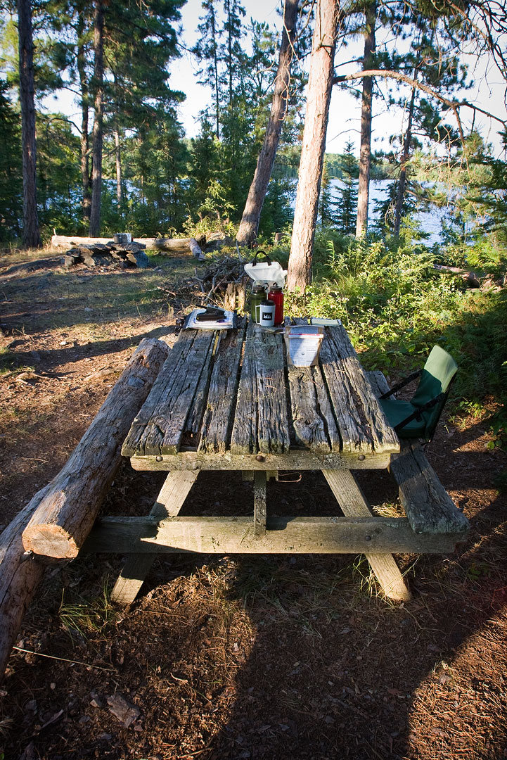
As I climbed ashore the island, my spirits rose. Opening up before me was a beautiful little campsite that had not been marked on the map. Better yet, it was vacant. The real surprise came, however, when I noticed a structure to the side, along the edge of some brush. It took a moment, but I quickly realized that I was staring at a picnic table. After a few weeks of primitive camping this object seemed completely out of place and was totally unexpected. Regardless, my tired legs were happy to see it, and after having passed motor boats and ranger stations the wilderness spell had already begun to lift.
The table itself looked quite old and was clearly in an advanced state of decay. Still, it had one good seat bench, and the top, though porous, could hold most things just fine. The missing seat bench had been replaced with a couple of logs, but both sides could hold a person's weight with no problem. Was this some relic of the past, left behind from the time before the area became a protected wilderness?
|
Once again I had lucked out by finding a great campsite, and this one would serve me well for my remaining time here in Quetico. Birch was clearly a busy lake, but I had found the perfect place to hide out.
|
Video (click image to play)
|
| << Prev | Next >> |
| A Quetico Solo | Copyright 2008 Tom Pinkerton |